Why it matters
The upper ocean is chronically undersampled
-
Forecasts are blind to subsurface ocean conditions
Storm intensity and ocean conditions depend on the upper ocean, which ships and moorings sample only occasionally.
-
Undersea operations need the water column
Sound speed changes with temperature and salinity. Without current profiles, sensing and planning work from estimates.
-
Observing at scale has been too expensive, slow, sparse, and sporadic
Ship time, specialized vessels, and expensive sensors limit how much of the ocean gets measured, and how often.
Platform
A unified platform for distributed ocean sensing
Fleets of sensors that stay on station for months and deliver data within an hour of surfacing.
- 01 · Vehicles Tensor™ A-size buoyancy-controlled Maneuverable Float™ with a modular sensor bay for CTD, sound velocity, hydrophone, ACOMMS, and partner payloads. Reusable or attritable. Tensor Vehicles
- 02 · Operations Tensor Operating System™ (TOPS™) Mission planning, path planning, and station keeping for the whole fleet, from a browser. TOPS
- 03 · Data Data Products Upper-ocean data delivered through a customer portal, with APIs for external tasking and data delivery. Data Products
Deployment & Scale
Deploy by air or sea
Apeiron lowers the cost of acquiring upper-ocean data by orders of magnitude.
-
01 · Deploy
Air, surface, or subsurface launch
Compatible with sonobuoy launch containers, surface vessels of opportunity, and subsurface vessels, with autonomous launch from uncrewed aircraft and vessels.
A-size · 10 kg -
02 · Operate
Persistent presence
Holds station within a 1 km watch circle for long-duration missions.
Months of endurance -
03 · Recover
Recover or expend
Recoverable at end of life or attritable, depending on the mission.
Reusable or attritable
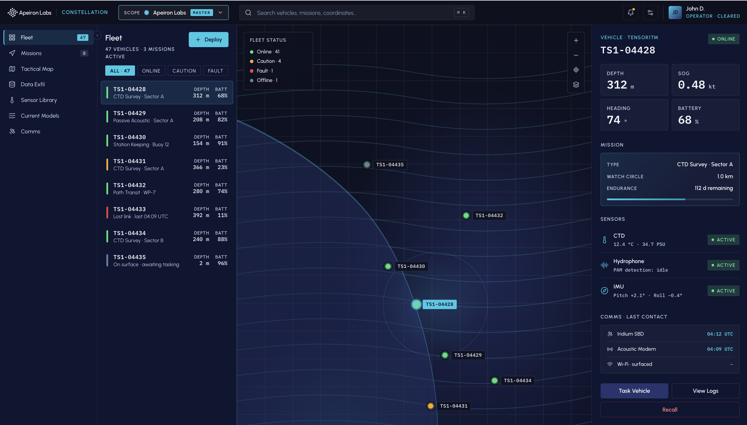
TOPS
Task fleet from any browser
Mission planning, station keeping, and data retrieval in one browser window.
- Mission planning
- Current modeling, any ocean
- Station keeping
- 1 km watch circle
- Comms
- Iridium · Wi-Fi · custom radio · 4G LTE (planned)
Missions
Dual-use by design
Upper ocean data for defense, civil, commercial, and research missions.
- Ocean & Weather Forecasting Supporting METOC, operational oceanography, and climate monitoring.
- Tactical Oceanography Persistent, high-resolution upper ocean data for operational planning.
- Undersea Warfare Environmental data that supports ASW and mine warfare operations.
- Offshore Energy & Aquaculture Persistent site monitoring for offshore wind and aquaculture operations.
- Research Affordable, mission-ready upper ocean data for scientific programs.
Engagement
Schedule a capability brief
Additional mission results available in a capability brief. NDA available on request.