The model
CubeSats for the Ocean
-
Standard size, mass manufacturable
An A-size form factor that fits existing sonobuoy launch containers and is designed for volume production.
-
Distributed arrays
Many affordable vehicles give persistent, wide-area coverage that a few high-end platforms can’t.
-
Data as a service
Customers task the array through TOPS and receive data.
Overview
Mission lifecycle
Ocean observing has relied on ships, moorings, and expendable sensors that are slow, sparse, and sporadic. Apeiron Labs replaces them with fleets of affordable, mission-ready Tensor vehicles that deploy by air or sea, sample the upper 400 m continuously for months, and can be recovered for reuse.
Vehicles
Tensor: a Maneuverable Float™
An A-size (36″ × 4.875″) Maneuverable Float that can drift, profile, glide, or loiter in the water column. It services the upper 400 m in littoral and deep-water regions, persistently loiters within a small watch circle, and is reusable or attritable.
- Hull rated to 1,300 ft (400 m)
- Patented ring wing; 3D-printed nose and tail
- Compatible with sonobuoy launch containers
- Scalable to larger form factors and endurances
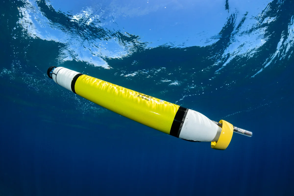
Tensor Specifications
- Weight
- 10 kg
- Length
- 36″ (914.4 mm)
- Hull diameter
- 4⅞″ (123.825 mm)
- Endurance
- Months
- Forward speed
- 0.5 kt
- Station keeping
- 1 km watch circle
- Communications
- Iridium · Wi-Fi · custom radio · 4G LTE (planned)
Specifications subject to change without notice.
Request the Tensor DatasheetPayloads & Integration
Modular sensors and communications
Standard sensors on every vehicle: pressure, GPS, and IMU. Sensor and communication packages swap by configuration, and customer sensors can be integrated by Apeiron Labs.
- CTDScience-grade conductivity, temperature, and depth (CTD), plus sound speed measurements
- HydrophonePassive acoustic monitoring with autonomous detection capabilities
- ACOMMSWHOI Micromodem for subsea acoustic communication
- Sound VelocityDelivers sound velocity profiles to 400 m
- Optional thrusterOptional thruster available for specific CONOPS
- Tailorable payloadsIntegrated by Apeiron Labs. Discuss requirements in a capability brief.
Communications
Iridium satellite, Wi-Fi, acoustic modem.
Optional extras
Lithium or alkaline primary battery, air launch package, CUI data
Deployment & Scale
Deployment at fleet scale
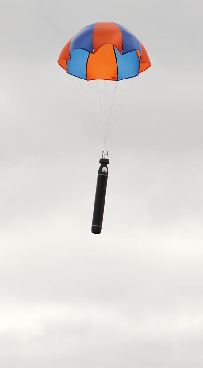
Easy to deploy via air or surface vessels of opportunity. Reusable or attritable.
- Air launch
- Sonobuoy launch containers
- Surface launch
- Vessels of opportunity
- Autonomous launch
- Uncrewed aircraft and vessels
- Lifetime
- A few months, depending on sensor power
- End of mission
- Attritable or recoverable
TOPS
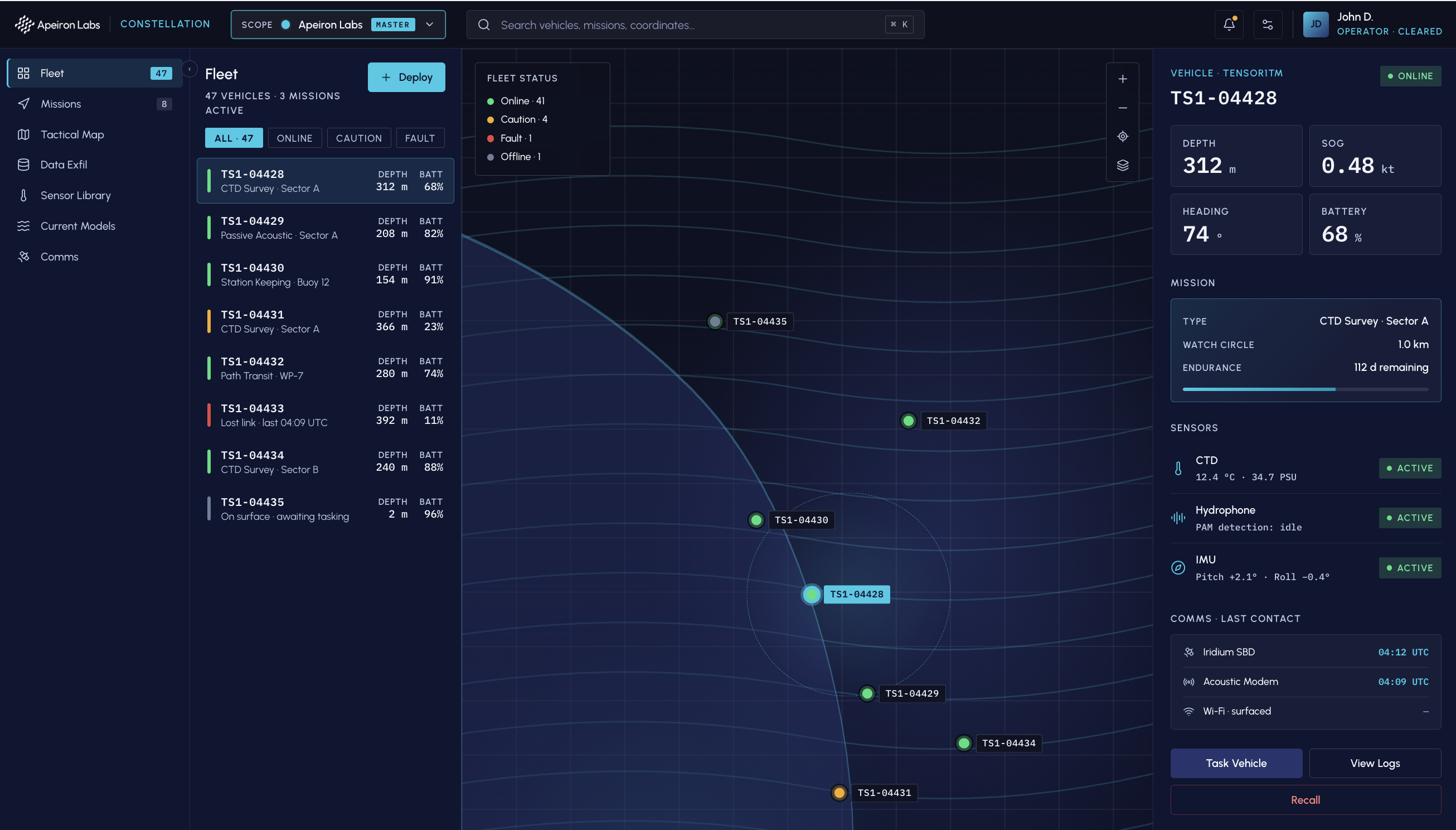
A fleet you can task from any browser
Complete cloud-based command and control using a web-browser.
-
Mission Planning
High-resolution current modeling in any ocean.
-
Path Planning
Logistics and fleet management.
-
Station Keeping
Spatially persistent sampling within a 1 km watch circle.
-
Cloud-based C2
Browser-based. No client install.
Data Products
Abundant upper ocean data at the lowest cost per 400 m profile
Access data through the customer portal, or integrate directly with APIs for external tasking and data delivery.
Validated in the field
- CTD and sound speed profiles
- Conductivity, temperature, and depth (CTD), plus sound speed, through the upper water column.
- Passive acoustic monitoring
- Hydrophone data with autonomous detection.
- Data exfil
- Iridium satellite, or subsea acoustic comms to a satellite gateway buoy.
- Delivery
- Customer portal · API for external tasking · API for data delivery
What you get from every profile
What you receive
| Depth (m) | Temperature (°C) | Salinity (PSU) | Density (kg/m³) | Sound speed (m/s) |
|---|---|---|---|---|
| 6 | 12.81 | 33.40 | 1025.21 | 1497.7 |
| 10 | 12.19 | 33.42 | 1025.37 | 1495.8 |
| 20 | 10.93 | 33.51 | 1025.74 | 1491.7 |
| 30 | 10.52 | 33.52 | 1025.86 | 1490.4 |
| 50 | 10.32 | 33.75 | 1026.16 | 1490.3 |
| 100 | 9.52 | 33.91 | 1026.63 | 1488.4 |
| 200 | 8.80 | 34.13 | 1027.37 | 1487.7 |
| 300 | 7.97 | 34.24 | 1028.05 | 1486.3 |
| 350 | 7.71 | 34.22 | 1028.31 | 1486.2 |
Request a Briefing
Additional mission results available in a capability brief. NDA available on request.